
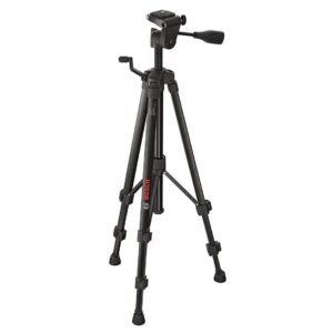
| Work height* | 55 – 157 cm |
| Weight, approx.* | 1.3 kg |
| Tripod thread | 1/4″ |
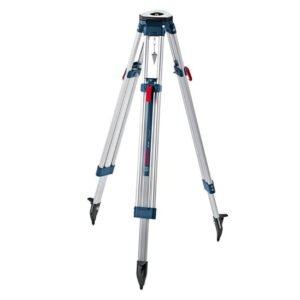
| Work height* | 97 – 160 cm |
| Weight, approx.* | 4.1 kg |
| Tripod thread | 5/8″ |

| Work height* | 97.5 – 250 cm |
| Weight, approx.* | 3.4 kg |
| Tripod thread | 1/4″ |
| Work height* | 107 – 165 cm |
| Weight, approx.* | 5.5 kg |
| Tripod thread | 5/8″ |
| Work height* | 122 – 295 cm |
| Weight, approx.* | 7.2 kg |
| Tripod thread | 5/8″ |

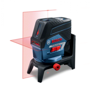
| Working range* | up to 15 m |
| Accuracy* | ± 0.3 mm/m* (*plus use-dependent deviation) |
| Laser diode | 630 – 650 nm, < 1mW |
| Operating temperature | -10 – 50 °C |
| Storage temperature | -20 – 70 °C |
| Laser class | 2 |
| Working range of laser points, max. | 10 m (top), 10 m (bottom) |
| Self-levelling range* | ± 4° |
| Levelling time | 4 s |
| Dust and splash protection | IP 54 |
| Power supply | 3 x 1.5 V LR6 (AA) |
| Operating time (max.) | 6 h in cross line and point mode, 8 h in cross line mode, 12 h in line and point mode, 16 h in line mode, 22 h in point mode |
| Tripod thread | 1/4″, 5/8″ |
| Weight, approx. | 0.49 kg |
| Colour of laser line | red |
| Projection | 2 lines / 2 points |
| Plumb point accuracy | ± 0.7 mm/m* (*plus use-dependent deviation) |
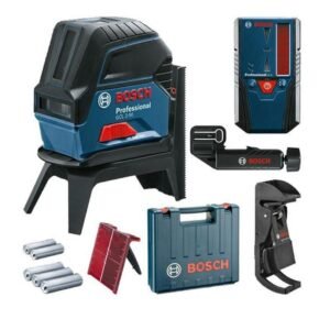
| Working range* | 20 m |
| Working range with receiver* | 50 m |
| Accuracy* | ± 0.3 mm/m |
| Laser diode | 635 – 650 nm |
| Operating temperature | -10 – 50 °C |
| Storage temperature | -20 – 70 °C |
| Laser class | 2 |
| Working range of laser points, max. | 10 m (top), 10 m (bottom) |
| Self-levelling range | ± 4° |
| Dust and splash protection | IP 54 |
| Power supply | 4 x 1.5 V LR6 (AA) |

| Working range* | 20 m |
| Working range with receiver* | 50 m |
| Accuracy* | ± 0.3 mm/m |
| Laser diode | 500 – 540 nm, < 10 mW, 630 – 650 nm, < 1mW |
| Operating temperature | -10 – 50 °C |
| Storage temperature | -20 – 70 °C |
| Laser class | 2 |
| Working range of laser points, max. | 10 m (top), 10 m (bottom) |
| Self-levelling range | ± 4° |
| Dust and splash protection | IP 54 |
| Working range* | 15 m |
| Working range with receiver* | 50 m |
| Accuracy* | ± 0.3 mm/m |
| Laser diode | 630 – 650 nm |
| Operating temperature | -10 – 50 °C |
| Storage temperature | -20 – 70 °C |
| Laser class | 2 |
| Working range of laser points, max. | 10 m (top), 10 m (bottom) |
| Self-levelling range | ± 4° |
| Levelling time | 4 s |
| Dust and splash protection | IP 54 |
| Power supply | 3 x 1.5 V LR6 (AA) |
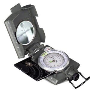
the # 4074 and # 4075 Konustar professional compasses were invented, designed and developed by Konus and are therefore a worldwide exclusivity that only our company can offer you. they have a full metal body and indispensable features like a clinometer, a level bubble, a tripod attachment and a 360° eyepiece.
| Battery voltage* | 12 V |
| Display size* | 3.5 “ |
| Display resolution* | 320 x 240 px |
| Diameter of camera head | 8.5 mm |
| Length of camera cable | 120 cm |
| Number of LED lighting stages | 3 |
| Weight | 0.64 kg |
| Display size* | 2.7 “ |
| Display resolution* | 320 x 240 px |
| Diameter of camera head | 8.5 mm |
| Length of camera cable* | 120 cm |
| Number of LED lighting stages | 3 |
| Weight | 0.5 kg |
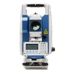
The CTS-112R4 total station is based on proven technologies and designed for users who need the most cost-effective survey solution. It has an angle accuracy of 2” and integrates a high efficiency EDM to provide measurement range of 800 m reflectorless and up to 5 000 m using a single prism, with millimeter accuracy.
Each replaceable battery provides 8 hours continuous working time, so you do not have to worry about losing power in the field anymore.
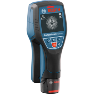
| Bosch Radar Technology* | yes |
| Max. detection depth* | 120 mm |
| Detectable objects* | magnetic metals (e.g. iron), non-magnetic metals (e.g. copper), live cables, non-live cables, water-filled plastic pipes, wooden substructures |
| Detection depth, magnetic metal, max. | 120 mm |
| Detection depth, non-magnetic metal, max. | 120 mm |
| Detection depth, live cables, max. | 60 mm |
| Detection depth, wooden substructures, max. | 38 mm |
| Accuracy | ± 10 مم mm |
| Views | Spot view |
| Wall types | Concrete, Drywall, Universal |
| Material identification | Live cable |
| Power supply | 12 V Li-ion or 4 x 1.5 V LR6 (AA) |
| Automatic deactivation, approx. | 5 minutes |
| Weight, approx. | 0.5 kg |
| Additional function | Dual Power (10.8 V/4 x 1.5 V LR6 AA); Centre finder with object direction indicator |

| Bosch Radar Technology* | yes |
| Max. detection depth* | 150 mm |
| Detectable objects* | magnetic metals (e.g. iron), non-magnetic metals (e.g. copper), live cables, non-live cables, plastic pipes, wooden substructures |
| Detection depth, magnetic metal, max. | 150 mm |
| Detection depth, non-magnetic metal, max. | 150 mm |
| Detection depth, live cables, max. | 60 mm |
| Detection depth, wooden substructures, max. | 40 mm |
| Accuracy | ± 5 مم mm |
| Views | Object view |
| Wall types | Universal, Concrete, Horizontal coring brick, Drywall, Panel Heating |
| Dust and splash protection | IP 54 |
| Material identification | Live cable, Metal |
| Power supply | 4 x 1.5 V LR6 (AA), 4 x 1.2 V KR6 (AA) |
| Automatic deactivation, approx. | 5 minutes |
| Weight, approx. | 0.65 kg |
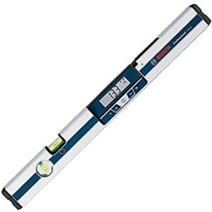
| Length* | 120 cm |
| Measurement range* | 0 – 360° (4 x 90°) |
| Electronics measurement accuracy 0°/90°* | ± 0.05° |
| Electronics measuring accuracy at 1– 89° | ± 0.2° |
| Measurement accuracy, vials | ± 0.057° = ± 1 mm/m |
| Operating duration, inclination measurem., approx. | 200 h |
| Weight approx. | 1.3 kg |
| Units of measurement | °, %, mm/m |
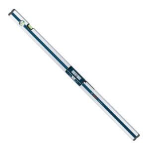
| Length* | 60 cm |
| Measurement range* | 0 – 360° (4 x 90°) |
| Electronics measurement accuracy 0°/90°* | ± 0.05° |
| Electronics measuring accuracy at 1– 89° | ± 0.1° |
| Working range (laser) | 30 m |
| Weight approx. | 0.91 kg |
| Laser type | 635 nm, < 1 mW |
| Laser range | 30 m |
| Laser class | 2 |
| Levelling accuracy of laser | ± 0,5 mm/m |
| Units of measurement | °, %, mm/m |
| Tripod thread | 1/4″ |
| Length* | 60 cm |
| Measurement range* | 0 – 360° (4 x 90°) |
| Electronics measurement accuracy 0°/90°* | ± 0.05° |
| Electronics measuring accuracy at 1– 89° | ± 0.2° |
| Measurement accuracy, vials | ± 0.057° = ± 1 mm/m |
| Weight approx. | 0.77 kg |
| Units of measurement | °, %, mm/m |
| Tripod thread | 1/4″ |
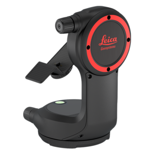
Transform your X-series DISTO into a professional measurement station.
The DST 360 is an intelligent adapter that transforms your DISTO X3 or X4 into a real measurement station, allowing you to accurately measure distances between any two points—what we call Point to Point measurement—from one position.
Designed for Point-to-Point (P2P) measurements.
When you use a DISTO X3 or X4 with the DST 360, your DISTO can combine rotation, angle, and distance data to produce highly accurate P2P measurements, which allows you to accurately measure distances between any two points from a third position.
Take accurate 3D point measurements.
Your DISTO X3 or X4 in combination with the DST 360 and the DISTO Plan App allow you to measure 3 dimensional points. X, Y and Z coordinates are recorded and can be exported into CAD.
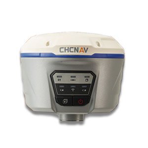
The i50 GNSS receiver brings complete your surveying and construction projects efficiently. Combined with our LandStar7 peed and accuracy in one easy-to-use GNSS solution to field software and HCE320 Android controller, the i50 GNSS is the perfect surveying solution for topographic and construction positioning tasks.
The i50 GNSS receiver integrates positioning and communication technologies in a rugged unit that is designed to provide work flexibility. When RTK corrections networks are unavailable at your job sites, just easily set up one i50 GNSS UHF base and use your i50 GNSS UHF rover to conduct your surveying tasks effectively.