• Leica GS07...

    The Leica GS07 is Leica Geosystems’ mid-range GNSS smart antenna. It is the lightweight yet robust piece of equipment which comes with functionality focused on exactly what you need, with the highest quality levels one would expect from a premium Leica Geosystems GNSS portfolio.

    AED د.إ0 Retail Price

    Leica GS07...

    AED د.إ0 Retail Price
  • Leica Viva GS16...

    Industry leading self-learning GNSS smart antenna.

    AED د.إ0 Retail Price

    Leica Viva GS16...

    AED د.إ0 Retail Price
  • Leica GS18 I GN...

    • Measure points with obstructed view to the sky more efficiently and easily.
    • Capture points you couldn’t reach before with a GNSS rover.
    • Gain more flexibility and control, with no need to use additional time-consuming equipment.
    • Map hundreds of points with survey-grade accuracy within minutes.
    • Capture the scene quickly and decide later, what should be measured – even if the scene subsequently changes or disappears.
    • Tap on an image to measure a point in the field or in the office.
    • Quick and thorough so you catch every detail.
    AED د.إ0 Retail Price

    Leica GS18 I GN...

    AED د.إ0 Retail Price
  • Leica NA700 Ser...

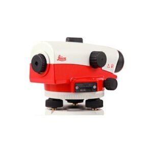
    The Leica NA700 levels defy the toughest of building site environments. Save time and money with no need for regular checks in the workshop or constant readjustment. When it comes to extreme robustness and optimum measuring accuracy, the Leica NA700 levels are hard to beat with:

    • Simple operation
    • No conversion from degrees to gon
    • Convenient pointing
    • Comfortable read-out
    • Constant clear view
    • Outstanding contrast
    • Impact-resistant
    • IP 57 Standard – water-tight and dust-tight
    AED د.إ0 Retail Price

    Leica NA700 Ser...

    AED د.إ0 Retail Price
  • Leica NA500 Ser...

    • Leica Geosystems is a pioneer in manufacturing levels and understands the needs of construction workers
    • Whatever your need, basic or more, Leica Geosystems levels are your answer
    • With a unique design, these levels produce the highest quality results at the best price value
    • The unique design of the Leica NA500 Series reflects the high quality of technology featured inside each level
    • The NA500 Series is ruggedly made to withstand the harshest elements
    • These levels, while highly accurate, provide quick and easy measurements
    • Rely on the known expert knowledge of Leica Geosystems with service centers worldwide ready to support you
    • Unbeaten warranty and service offering
    • Leica Geosystems offers solutions for all your construction needs
    AED د.إ0 Retail Price

    Leica NA500 Ser...

    AED د.إ0 Retail Price
  • Leica NA300 Ser...

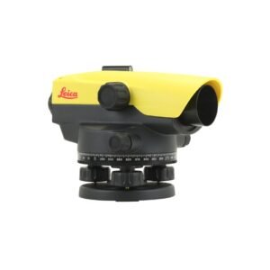
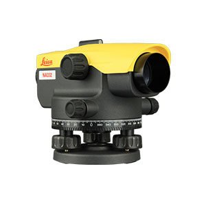
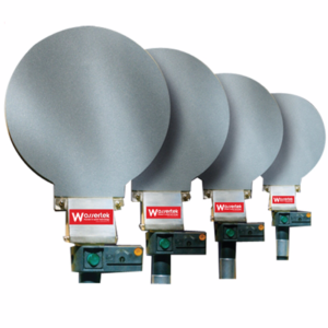
    The Leica NA300 Series of automatic (optical) levels has been developed for professionals who are looking for the highest quality results day by day. With the many obstructions and uneven surfaces on construction and building sites, the levels NA300 levels rise to the occasion and ensure the straightest and safest construction possible.

    The NA300 Series is your reliable partner for accurate measurements and high quality results:

    • Distinctive design and proven technology, inside and out
    • Leica Geosystems understands construction and provide levels for all needs
    • Protected shape for increased ergonomic handling while ensuring the highest quality results
    • Simple handling for quick and accurate measurements
    AED د.إ0 Retail Price

    Leica NA300 Ser...

    AED د.إ0 Retail Price
  • Line Laser GLL ...

    Working range* up to 15 m
    Accuracy* ± 0.3 mm/m* (*plus use-dependent deviation)
    Operating temperature -10 – 50 °C
    Storage temperature -20 – 70 °C
    Self-levelling range* ± 4°
    Levelling time 4 s
    Dust and splash protection IP 64
    Power supply 4 x 1.5 V LR6 (AA)
    Tripod thread 1/4″
    Weight, approx. 0.57 kg
    Colour of laser line green
    Projection 2 lines
    AED د.إ0 Retail Price

    Line Laser GLL ...

    AED د.إ0 Retail Price
Translate »

Main Menu