-
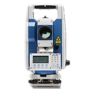
CTS-112R4 Total...
The CTS-112R4 total station is based on proven technologies and designed for users who need the most cost-effective survey solution. It has an angle accuracy of 2” and integrates a high efficiency EDM to provide measurement range of 800 m reflectorless and up to 5 000 m using a single prism, with millimeter accuracy.
Each replaceable battery provides 8 hours continuous working time, so you do not have to worry about losing power in the field anymore.
AED د.إ23,243 Retail PriceCTS-112R4 Total...
AED د.إ23,243 Retail Price -
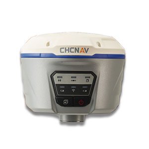
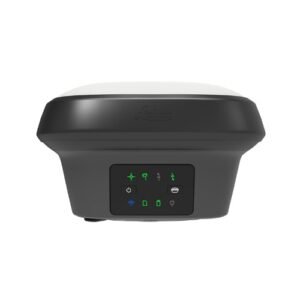
GPS Station Chc...
The i50 GNSS receiver brings complete your surveying and construction projects efficiently. Combined with our LandStar7 peed and accuracy in one easy-to-use GNSS solution to field software and HCE320 Android controller, the i50 GNSS is the perfect surveying solution for topographic and construction positioning tasks.
The i50 GNSS receiver integrates positioning and communication technologies in a rugged unit that is designed to provide work flexibility. When RTK corrections networks are unavailable at your job sites, just easily set up one i50 GNSS UHF base and use your i50 GNSS UHF rover to conduct your surveying tasks effectively.
AED د.إ50,784 Retail PriceGPS Station Chc...
AED د.إ50,784 Retail Price -

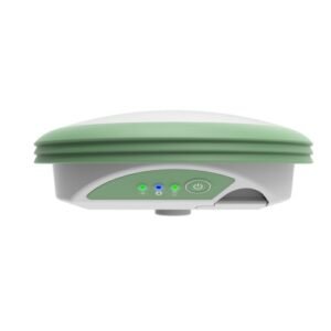
I70 Smart Gnss ...
Leveraging advanced GNSS teproven and outstanding performances and reliability. It makes it one of the preferred choices of chnologies, the i70 GNSS is a smart antenna receiver offering land surveying and construction professionals.
The i70 GNSS benefits from a compact and rugged design with integrated 3.75G network modem, UHF Radio, Wi-Fi and Bluetooth. Its high-resolution LCD display shows the receiver status at a glance to always keep control of your survey operation.
AED د.إ0 Retail PriceI70 Smart Gnss ...
AED د.إ0 Retail Price -

-
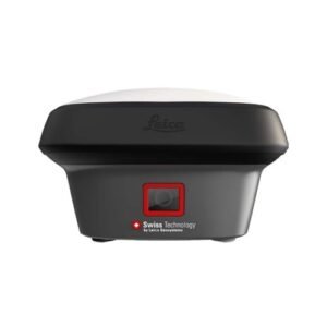
Leica GS07...
The Leica GS07 is Leica Geosystems’ mid-range GNSS smart antenna. It is the lightweight yet robust piece of equipment which comes with functionality focused on exactly what you need, with the highest quality levels one would expect from a premium Leica Geosystems GNSS portfolio.
AED د.إ0 Retail PriceLeica GS07...
AED د.إ0 Retail Price -
Leica GS18 I GN...
- Measure points with obstructed view to the sky more efficiently and easily.
- Capture points you couldn’t reach before with a GNSS rover.
- Gain more flexibility and control, with no need to use additional time-consuming equipment.
- Map hundreds of points with survey-grade accuracy within minutes.
- Capture the scene quickly and decide later, what should be measured – even if the scene subsequently changes or disappears.
- Tap on an image to measure a point in the field or in the office.
- Quick and thorough so you catch every detail.
AED د.إ0 Retail PriceLeica GS18 I GN...
AED د.إ0 Retail Price -
-

Leica Viva GS16...
Industry leading self-learning GNSS smart antenna.
AED د.إ0 Retail PriceLeica Viva GS16...
AED د.إ0 Retail Price